Michigan
- Has two peninsulas, with lots of water in-between
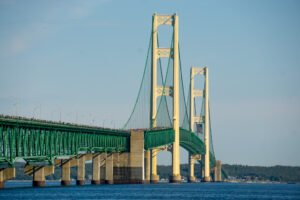
- Has an amazing suspension bridge (Was the world record holder for total suspended length for quite a while after being built in 1957)
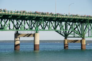
- Opens the bridge to pedestrian traffic once a year on the morning of Labor Day
In 45 years, I had never gone up for the bridge walk, so I figured I should go see / do it at least once.
How the event works (currently)
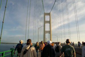
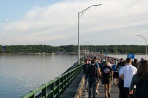
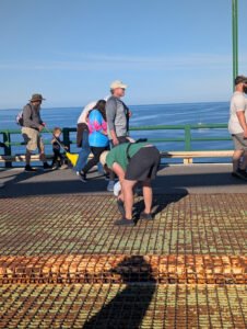
The bridge is open to pedestrian traffic from both the south and north. The outer lanes (not the grates) are open to walking while the inner lanes are reserved for emergency vehicles. The walk starts at about 7AM with the Governor leading the way (north to south) and goes until 11:30. Within that window, you can start whenever you want and walk as much of it as you want, but at 10:00 the span starts closing from the middle and the turn-around point moves progressively toward the ends. Eg. if you want to, you could start at 10:30, walk a mile of the approach and turn around.
The event used to be a one-way walk with shuttles. I think the shuttles ceased a few years ago and I assume the two-way option was added then.
My plan and execution thereof
I wanted to walk the whole span, I didn’t arrange my own shuttle and I didn’t want to pay $30 for a Uber ride across the bridge hours later. So I was trying to go both directions – meaning I needed to be past the half-way point on my return trip by 10:00 to not get cut off. I didn’t know how strict they were going to be with that cutoff, but I figured I needed to be on my way back by 9:00 at the latest.
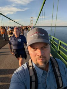
I started off working against myself slightly – I mistakenly thought the walk started at 7:30. I thought I’d get to Mack inaw City about an hour beforehand to find parking, pack up, find a bathroom, get in line and go. I didn’t really know what to expect, and my biggest concern was getting parking – there are far far far more people doing the bridge walk than the city can realistically handle. I ended up getting there around 6:25, drove a bit too far into town (past any open parking spots) and then turned to head west out of town and found parking on some random street on the “other side” of the freeway (AKA bridge). I packed up my backpack and was in town around 6:55, stopped by the restrooms and was headed toward the start line about 7:10.
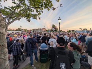
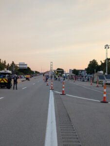
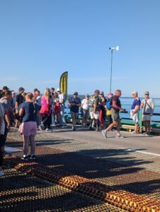
The start line was a lot like a start corral at a big city 5k race, but with no waves or actual corral fences, so it was more of a start mob. I just moved around the edge toward the front, having noted on the map that there is a pretty obvious “entrance” to the bridge from town. There’s typically no pedestrian access and thus no pedestrian walkway, so the walk start from Mackinaw is just the last “freeway” on/off ramp before the bridge. By my picture timestamps, I’m pretty sure I was on the route by 7:20.
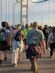
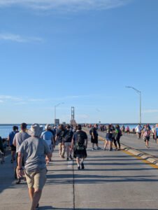
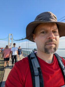
The walk is 5 miles each way (on-ramp to on-ramp), a suspended length of 2.43 miles which leaves about 1.3 miles on each end as the approaches to get to the suspended portion. There were lots of people – it was pretty crowded both ways. There’s no running – running would have been all but impossible anyway. There is an organized run before the walk that was finishing in Mackinaw City about when I was starting and I think some of those finishers then walked back. It’s all theoretically (semi-enforced) one lane, so passing definitely happens, but isn’t always easy.
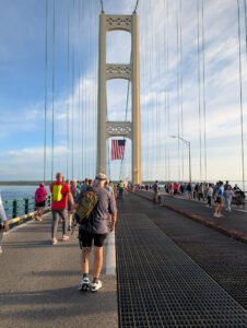
The bridge is four lanes – two each way. Having tens of thousands of people walking right next to a lane that looks open is a recipe for people ignoring the rules. So, there were helpers and state police every 1/8 mile or so, constantly telling everyone to get back in the left lane. People would compress and then almost immediately expand back into the inner lane. I’m sure it was more accessible to emergency vehicles than it otherwise would have been (and there were a few), but about 30% of the chatter on the first pass was people complaining about the lanes.
I really wasn’t sure how fast I’d be walking in such a crowd, so I was just trying to make constant progress. I also tried not to stop for pictures because stopping is kind of a mess with that many people. My pace was pretty much 40 minutes per half with 10 minutes break at the turn. I passed the half way point on the return at 9:25, so plenty of time for the 10:00 cutoff.
The walk itself was semi-interesting – to be totally fair, you see the same things if you drive across, so there was nothing new. The most interesting part was the amount of movement in the bridge that either doesn’t happen with vehicles or you don’t feel. Apparently a few GR people were up there as well, but I didn’t know and didn’t see them even though I did keep an eye out. It was a beautiful day with no adverse weather to speak of, so you could reduce this to a walk on a paved trail with a tiny bit of elevation change and bathrooms at the half-way point. Grueling.
Planning tips and thoughts
I was far more worried about wind and temperature for clothing choices than ended up being necessary (to be fair, it was a beautiful day). Shorts and a t-shirt would have been fine as long as you were warm enough in the staging area. Sunscreen optional, mostly for the second half. Same for the hat. I drank roughly a liter of water and ate some almonds and an apple as snacks. Realistically, for a 10-mile, 2.5 hour hike with no elevation, snacks are optional. Also, if you are comfortable walking 10 miles, you probably have a good idea of how much water you’re going to want.
My other advice would be to arrive maybe 30 minutes earlier – probably 5:45 or so. I think with a lot of events, the time it takes to find parking starts to increase as you get closer to the start, so if you’re running late, things are going to take even longer, making the problem worse. I’m really not sure what the people who arrive after the start do – I got there about 30 minutes before the start and still had to “explore” to find parking. I had about 30 minutes leeway on my timing to get back across. If you’re doing only half, then you could probably start at 9:00 and be fine, but you’ll still spend too much time searching for a parking spot if you arrive later.
Unsurprisingly, there are no toilets on the bridge span, but there were plenty at each end, though there were also lines, so plan time as necessary.
I was there solo. While it would be fun to do with a friend or two, it could also get notably slower. It’s crowded. You’re trying to navigate a crowd, quickly, for five miles and then turning around to do it again. That gets exponentially harder as you add people to your party. Obviously, lots of people are were there with groups, and it’s meant for anyone and everyone to be able to participate. Pairs tended to work out OK, sometimes trios. At the extreme, you get the families of four or five that think they should all walk four abreast and block the entire lane at the speed of the stroller that someone is pushing. They’re obviously not super concerned with speed.
To do the over-and-back route, you have up to 1 hour per half. That’s pretty doable, but it will be slower than expected. All told my pace was 16 minutes per mile, which is pretty slow for a walk, but OK for a hike. I wasn’t being aggressive about speed, but I was being intentional because I didn’t quite know what to expect and I really didn’t want to get stuck on the other side of the straits. If you were just starting as close to 7AM as you could and moving with the crowd, you’d likely be OK.
Traffic on the trip home, given that it was the last day of Labor Day Weekend, was kind of rough, but that just goes with the territory I guess.